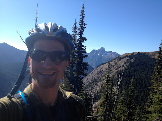
i parked and was riding by 6:30 am. the initial trail was done in the awakening dark. as the light strengthened, colours emerged, framing the wide singletrack leading up the shoulder of the mountain.
after two hours of climbing the first views of planned route opened up. the trail i was riding reached the right flank of that rocky peak in the distance, which, employing a deliberate malapropism, i will refer to as mount hozermean. the aforementioned edifice lies 80% across the border, and i've heard it's top secret. so lets just keep this little trip between us.
this view hopeful but sorrowful as well, because it meant i would have to give up some of my hard fought elevation, descend to the right and then ascend the spine of the mountain in the foreground.
after a switchback descent, it was time for climbing again.
this second push was rewarded with an entrance into open alpine.
love the alpine. especially on a blue sky day. at this point it was about 9 am. pretty cold up there, but not windy thankfully.
the initial goal had been one of the peaks in the traverse, but from a distance i saw this beautiful ridge buttressing hosermean. i had to check it out.
the hosermean ridge was every bit as wonderful as it looked from a distance. although the trail was a bit overgrown in places it had a real garden of eden feeling to it.
gorgeous foliage with beautiful views in all directions. warm morning sunshine. no one else in the entire greater valley. a perfect spot for lunch and a rest.
on the way back i took a side trip up the tallest peak in the ridgeline. the trail follows the ridge on the left of the above picture. fantastic views with the occasional bit of exposure.
another hour or two of biking and i'm a few mountains over. hosermean slowly receding over my shoulder.
another nice spot for a break. while resting here i thought i just had downhill riding left to take me to the car, but boy was i wrong. it started with some sweet downhill, but then i had to ascend two or three more peaks, each successively higher.
finally i actually did reach the point where it was all downhill to the car. this picture shows the day quite nicely. biking the ridgeline meandering away into the distance and eating lunch on the shoulder of hozermean, the rocky double peak on the left. then ascending the middle peak on the right on the way back. i was pretty beat.
luckily at that point i had nothing left but buff singletrack through an old burn, and eventually through dense forest. super fast and fun, with slabs of rock or gnarled roots making sweet kickers all over.
for the first time i can remember, i had the cartoon experience of being lifted off of my bike by my backpack. i came cooking around this corner, saw the tree and ducked down low thinking i had made it. suddenly i'm sitting on my butt on the trail, my bike continuing on without me. i can't show you my bruises, but i can show you the bruise i am currently sporting from that tree that jumped in my way in the whistler bike park.
sorry, back to the trail. the singletrack continued down the slope, fast and snaky. as mentioned, once this trail started going down, it meant it. losing 800m in 8km of trail is a lot of fun.
speaking of elevation, this elevation vs. distance map makes it clear what makes this ride so amazing. the elevation is all gained early, the entire day is spent in alpine and subalpine meadows, and then you get to come ripping down at the end. sweet.
45km of heartpounding singletrack through incredible country. the roundtrip was just under 8 hours. the trailhead is just over an hour's drive from our house. i won't give you the directions online, but come on over and i'll take you there!


3 comments:
This was so interesting, Marc. Sounds like you really had a good day. Lots of beautiful pictures. Fun. love from Aunt Cheryl
I love the 'careful route plan left with Kylie.' No worries you were covered: 8 hours of biking through the mountainous wilderness, country unclear, what could happen? :)
Lovely pictures (minus the ouchie leg). You are quite the Mr Adventurer Man!
Post a Comment